 |
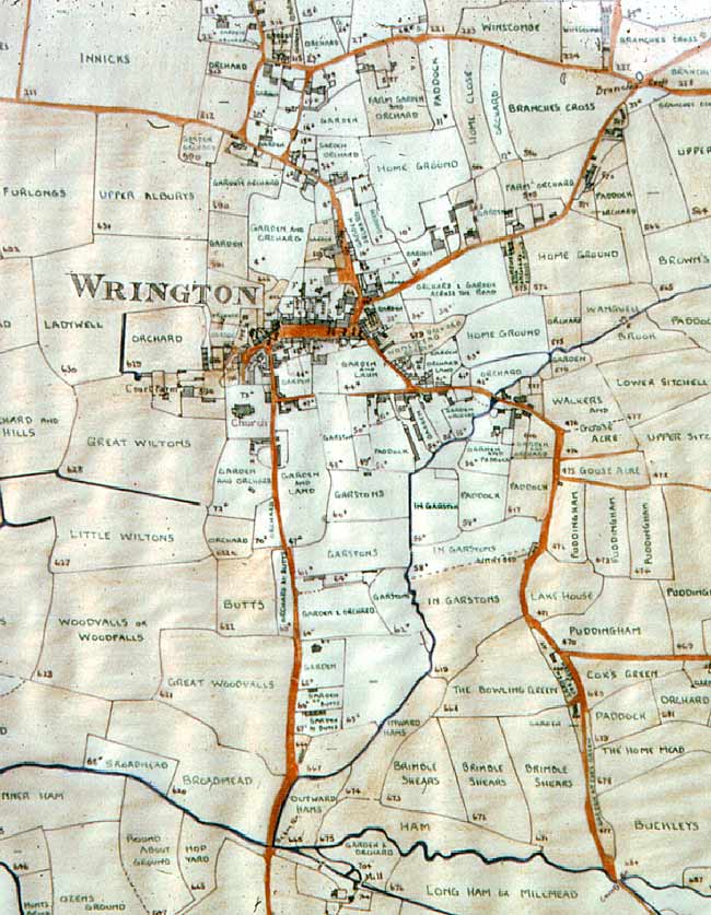
Wrington HISTORY Tithe Map of 1839 central area |
|
|
Wrington HISTORY Tithe Map of 1839 central area |
|
 |
|||||||||||
|
Tracing by the late Hugh Smith of the central area of the Tithe Map of 1839 shaded to indicate the areas owned by the Manor of Wrington: |
|||||||||||
|
|||||||||||
![]()
