 |
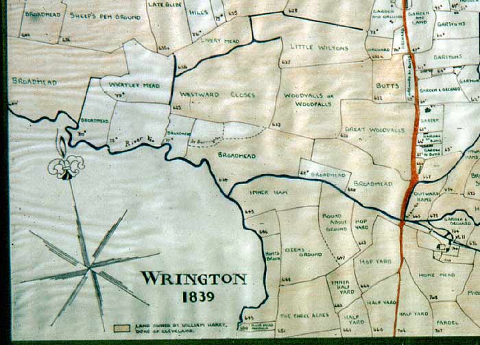
Wrington HISTORY Tithe Map of 1839 South-west segment |
|
|
Wrington HISTORY Tithe Map of 1839 South-west segment |
|
 |
||||
|
South-west segment of the tracing by the late Hugh Smith of the Tithe Map of 1839. Shaded areas owned by the Manor of Wrington: |
||||
![]()
